Meandering Through Mineral County With Jim Cyr
A practical hiking guide to the backwoods trails, lakes and historical sites in Mineral County in Western Montana
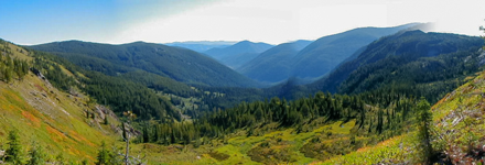
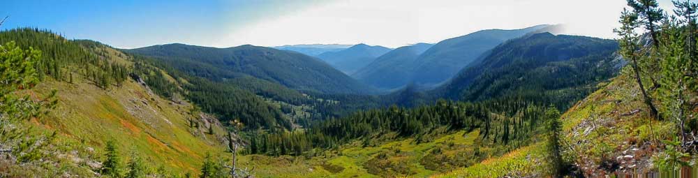
Mineral Country encompasses 1,223 square miles and was the 54 county to be recognized as Montana’s independent county in 1914. There is relatively little population in the county with Alberton, St Regis and Superior containing the majority of its inhabitants. Most of it is a rugged vast wilderness that is contained within the Lolo National Forest. A wilderness steeped in a rich history of mining and logging and the famed Mullan Trail becoming one of the main arterials through this pristine valley weaving its way up over a mountainous pass. It is said that The Clark Fork River carries more water than any other river in Montana that runs through the bottom of its meandering valleys. It is populated with ponderosa pines, lodge poles pines, douglas firs, eastern larch, with pockets of beautiful cedar groves. The high mountains contain pristine spring fed lakes that remain icy cold even in the peak of the hot summer months and are abundant with Brook, Native Cutthroat, Yellowstone Cutthroat, and some Rainbow Trout. Almost every drainage leads to or contains some remarkably beautiful spot. In many ways this area still feels untouched and to wander this land is like stepping back into a simpler more beautiful time.
Jim Cyr has spent a lifetime exploring, logging, and uncovering its historical riches. This is meant to be a self guided hiking tour through this vast wilderness and seemingly out of reach places, from the highest peaks to its lowest valleys.
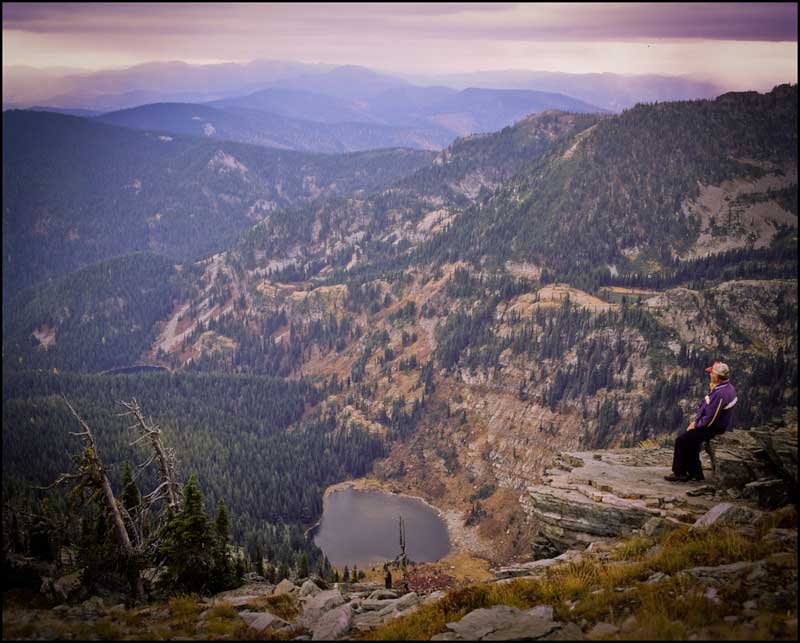 Jim Cyr on Eagle Peak overlooking Hub Lake